Hurricane Beryl

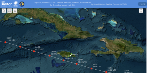
Hurricane Beryl, the strongest hurricane in history to form in June in the Atlantic Ocean, wreaked havoc as it swept through Grenada, Saint Vincent and the Grenadines and Jamaica.

Initially a tropical depression, Beryl rapidly intensified into a Category 4 hurricane and briefly reached Category 5 status, with winds up to 240 km/h (150 mph).

Common Operational Datasets (CODs)

Click on the links below to get the Subnational Administrative Boundaries and to Subnational Population Statistics datasets.

Latest OCHA Situation Reports and Flash Updates

ReliefWeb results

Saint Vincent and the Grenadines + 4 more

Latinoamérica y El Caribe Resumen de Situación Semanal al 9 de agosto 2024

CIFRAS CLAVE 66% de probabilidad de condiciones de La Niña para septiembrenoviembre de 2024 $230,6M estimados en pérdidas económicas en San Vicente y las Granadinas debido al huracán Beryl 150 familias desplazadas o confinadas en los departamentos del oeste…

Format:
Situation Report
Source:
OCHA
Posted:
9 Aug 2024
Files:
Download
View all updates

Satellite Based Maps and Analysis

Emergency Response Activities Dashboard - Who, What, Where (3W)

Want to report your activity? Click here.

Want to download the dataset? Visit HDX.

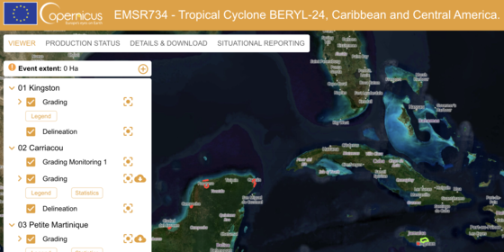
Hurrican Beryl Impact on Residential Buildings - Copernicus

Latest Assessments

ReliefWeb results

Barbados

Initial Assessment Report Hurricane Beryl: Barbados (12 August 2024)

The secondary data in this report is sourced from the Data Entry and Exploration Platform (DEEP) Atlantic-Caribbean Hurricane Season 2024 Project, launched on 03/07/2024, following Hurricane Beryl's impact on four Caribbean islands, including Barbados. Coordinated with…

Format:
Assessment
Source:
IFRC
Posted:
21 Aug 2024
Files:
Download
View all updates

Latest Analysis

ReliefWeb results

View all updates

Latest Appeals

ReliefWeb results

View all updates