Hurricane Beryl

Hurricane Beryl, the strongest hurricane in history to form in June in the Atlantic Ocean, wreaked havoc as it swept through Grenada, Saint Vincent and the Grenadines and Jamaica.

Initially a tropical depression, Beryl rapidly intensified into a Category 4 hurricane and briefly reached Category 5 status, with winds up to 240 km/h (150 mph).

Common Operational Datasets (CODs)

Click on the links below to get the Subnational Administrative Boundaries and to Subnational Population Statistics datasets.

Latest OCHA Situation Reports and Flash Updates

ReliefWeb results

View all updates

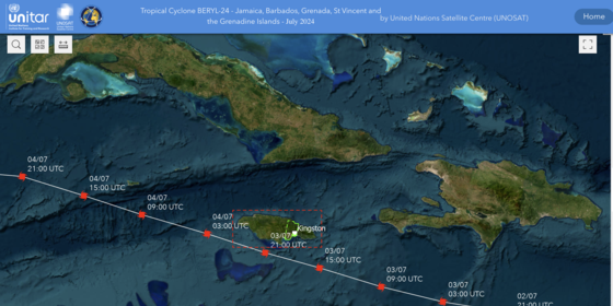
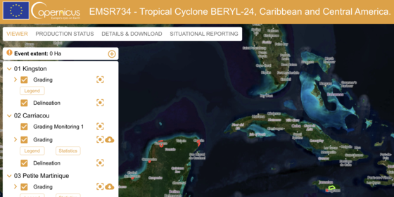
Satellite Based Maps and Analysis

Emergency Response Activities Dashboard - Who, What, Where (3W)

Want to report your activity? Click here.

Want to download the dataset? Visit HDX.

Hurrican Beryl Impact on Residential Buildings - Copernicus

Latest Assessments

ReliefWeb results

Jamaica

Jamaica: Assessment locations - 10 and 15 July 2024

Map shows the location of the assessments carried out on 10 July 2024. Teams included members from ODPEM, UNDAC, OIM, FAO, UNDSS, UNDP, UNICEF, ATLAS, JEU and TSF. Roads, railways, parish and community boundaries are shown…

Formato:
Mapa
Origen:
MapAction
Posted:
24 Aug 2024
Archivos:
Descargar
View all updates

Latest Analysis

ReliefWeb results

View all updates

Latest Appeals

ReliefWeb results

View all updates